When location matters in the every day life of the Danube region countries
Join the first Open (Geo) Data hackathon in Bratislava, Slovakia
Date of the event: 15th - 17th October 2015
Venue: ImpacHub Bratislava
#DanubeHack

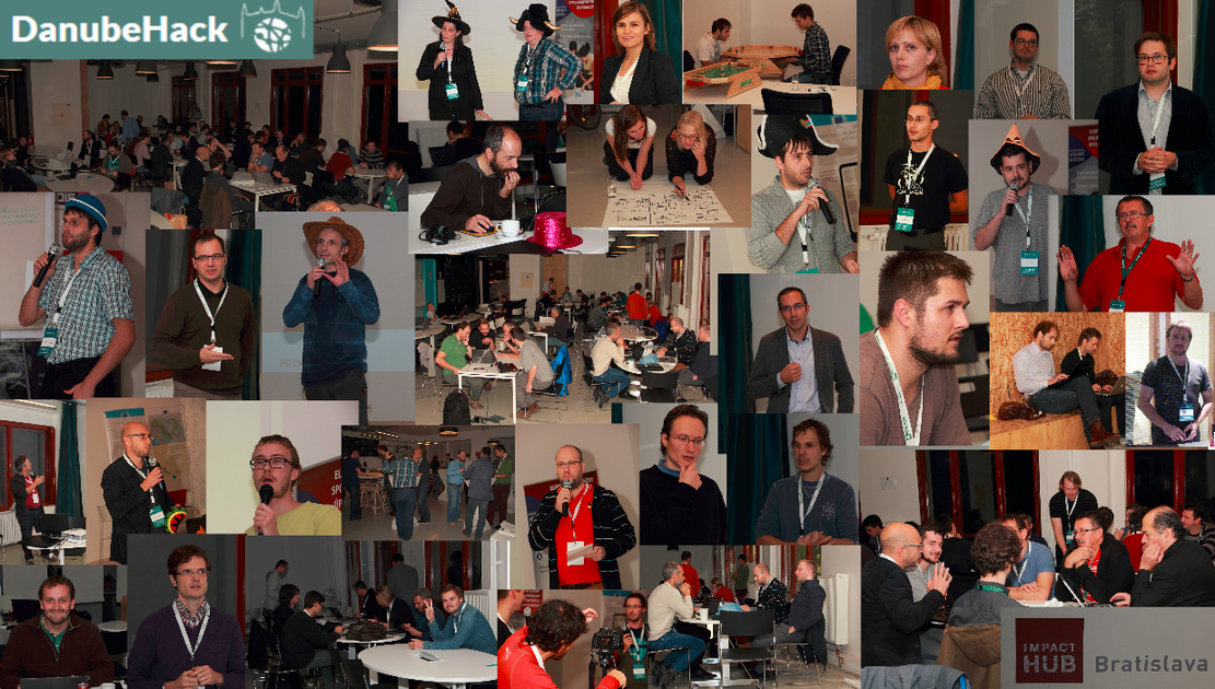
Photo gallery of the event.
Smart Land (We learn to farm) [1st place]
Team: Boglárka Ivanegová, Boris Kružliak, Michal Dolník, Ladislav Morávek, Michala Hrnčiarová, and friends
Description:
Identifying unused urban and rural properties and creative bottom up initiatives in their surroundings. Linking owners of these properties with potential new users. Motivating through the best practices of the creative bottom-up initiatives. Connecting all these layers to trigger better livelihoods in both cities and rural regions :)Used data resources:
Used technologies: Apache HTTP Server Project, JavaScript (jQuery, Bootstrap, Handlebars, Mapbox, Leaflet), HTML, SQL, CSS (Bootstrap), Azure; Software: PostgreSQL, PostGIS, qGIS, GRASS-GIS, Chrome
Sources:
Team: Marček Ján, Tomáš Matula, Karol Bujaček, Martin Měkota, Ondrej Kozlovský, Ján Ferko
Jira usage in context of geodata aimed towards municipalities.
Sources:
Team: Richard Laffers, Pavol Bučko
Live map of public transportation vehicles for the city of Bratislava. App will be deployed in the near future under the http://imhd.sk.
Used data resources: dpb.sk via imhd.sk API
Used technologies: Javascript, Leaflet, OpenStreetMap, SASS, Grunt
Sources:
Team: Gerhard Dünnebeil, Kathi Schleidt, Tomáš Kliment
Visualisation of data from an INSPIRE/Air Quality server set. This includes locations (Samples, Stations) from a WFS as well als Measurement Data from an SOS.
Used data resources: Test Data based on Austrian's UBA Air Quality data
Used technologies: OpenLayers 3
Sources:
Team: Dmitri Kožuch, Simon Leitgeb, Jachym Kellar, Jachym Cepicky, Alix Guillard
The aim is to make simple tourist planner that will make use of the huge amount (4000000) of POI that was collected and stored in SPARQL database within SDI4Apps project.
Sources:
Team: Peter Kopčanský, Peter Klobušník
ClearStreets brings you the information when a street was cleaned of snow and is safe to drive.
Sources:
Team: Alix Guillard, Miro Jánošík
Put french voters living abroad on a map with voting method, keeping privacy safe
Used technologies: javascript, Leaflet, OSM, php
Sources:
Team: Michal Páleníkcute;nošík, Boris Kružliak
Created dump of addresses from datagov.sk (addresses provided by the Ministry of interior of SR), which will be suitable for further use including basic online visualisation.
Used data resources: Addresses provided by the Ministry of interior of SR
Used technologies: "backend: bash+postgis+(small php by http://www.oma.sk/api); fronted:leaflet, js and http://epsilon.sk/dynamicke/"
Sources:
Team: Jakub Kočica, Tomáš Kliment, Jáchym Čepický
Coverage service for annual precipitation in Slovakia for years 2009 and 2010 in resolution 0,5 km
Used data resources:
Used technologies: OpenLayers, QGIS, Tabula
Sources:
Despite the increasing amount of the data that is created and made open in the Danube region, its practical use is still facing various challenges. In the case of geo data the situation is even more tricky. Similar conditions relate also to the software tools helping to collect, manipulate and publish such data.
To proof that there is potential in this data, present what’s behind you and your mates! Identify the possibilities, pitch ideas, promote your data, re-use available open data & software technologies to create new data, software, apps, or visualisations! Provide the proposals/expectations for workshops! And last but not least meet new people and spent two nights in Bratislava close to the Danube river.
Preliminary areas of Open data domains foreseen to be combined with identified geo data:


In order to support the participants of the event

Jáchym is a developer specialized on map apps and the original author of Python Web Processing Service. He contributes to many opensource projects and is a founding member of OSGeo.cz and a member of Open Source Geospatial Foundation. He works as a (Geo)Python trainer at GISMentors and a programmer at Geosense.


Michiel is a Linked Data specialist. Creating APIs for Linked Data with Spinque.

Tomáš is specialist for work with Linked Data and its querying with SPARQL.
Jano is an open data activist and developer.
Jozef is a GIS and Remote Sensing specialist. He analyzes vector or raster special geographic data. He has been involved in the international projects such as CORINE Land Cover Projects.
Martin is specialist for data processing (vector, raster) and its preparing for web publishing.

Kathi is a specialist for the provision of observational and measurement data within INSPIRE

Gerhard does software design, coding and maintenance it for several air quality monitoring networks in Austria and world wide. Counseling on architectures for networks.

Alex is an expert in geospatial data management and interoperability. He currently works at the Joint Research Centre.

Iveta works at the ÚSV ROS. She is in charge of implementation of slovak OpenGovernmentPartnership commitments in area of civil participation. She coordinates development of national project of ÚSV ROS in area of supporting civil participation. She was dealing with open data issue during her intership at ÚSV ROS.
Michal specializes on OpenSource GIS, is a consumer of OpenStreetMap and creator of www.oma.sk. He cooperates on freemap.sk and teaches courses linked to OSM at the Faculty of natural sciences of the Comenius University.
Tomáš is a researcher who has been working in several European, regional and local projects focusing on geospatial resources discovery, data and metadata workflows automation. He currently holds postdoctoral position at the University of Zagreb funded by NEWFELPRO program.
https://about.me/klimeto
It’s not about winning—it’s about learning and making contacts, friends and networks (so everyone’s a winner!). A panel of professional judges will select the best outcomes. Prize list:
1.Place "Smart Land": 1500€ and WebSupport Virtual server V2 for 1 year,
2.Place "Geo4Jira": 1000€ and WebSupport - The Hosting for 1 year max. size 3GB
3.Place "City Transport Map":500€ and WebSupport - The Hosting for 1 year max. size 3GB
Prizes have been supported by:
SAZP, NASES, ProNatu r, EEA foundation, E-Pro, Ness KDC, WebSupport, HERE
Two parallel sessions are foreseen, providing the space as for developing new apps, services and data as well as session offering knowledge sharing via workshops, including the provision of space for discussions on relevant topics.
Warm up, by presenting the aim of the event, input data and technology as well as participants. Pitching the ideas into the projects and setting up the project teams.
Launch of the coding, projects shaping, midhack and execution of the workshops.
Day 1 follow up, presentation of the projects outcomes, evaluation and awarding of the best ones and the outlook for the future possible activities.
Programme with the links to the presentations.
| Day/Deň | Time/Čas | Hack Session/Sekcia | Workshops, Pannel Session/ Sekcia Workshopovov, Panelu | Author/s | Language/Jazyk |
|
Day 0 Thursday |
17:00 | Registration | EN | ||
| 18:00 | Invitation and introduction of the event | EN | |||
| 18:15 | Organizational information, presenting of mentors | EN | |||
| 18:30 | Pitching/Collection of the project ideas - 2 mins/per person. Elevator pitches,no slides. | EN/SK | |||
| 19:00 | Creating the teams | EN/SK | |||
| 19:30 | Dinner | Dinner | |||
| 20:00 - 24:00 | Evening Hacking | Invitation and introduction of the workshops | EN | ||
| Data and technology intro (Presented by the relevant data producers/publishers max 5-10 mins./each): | |||||
| Data: | |||||
| * SAZP Corine Landcover | Jozef Nováček | SK+EN slides | |||
| * SAZP Basic settlements units | Martin Zeman | EN | |||
| * SAZP Historical maps | Martin Zeman | EN | |||
| * OpenStreetMap essentials | Michal Páleník | EN | |||
| *SmartOpenData Linked Data | Martin Tuchyňa | EN | |||
| * Addresses register | Lubor Illek | SK | |||
| Technology: | |||||
| * Open Data Node | Peter Hanečák | EN | |||
| * ODN/UnifiedViews in particular | Tomáš Knap | EN | |||
| * SDI4Apps Points Of Interrest (POI) | Karel Charvát | EN | |||
| 00:00 | End of day 0 | End of day 0 | |||
|
Day I Friday |
08:30 | Breakfast | Breakfast | ||
| 09:00 |
Hacking |
OpenData in Danube region context | Alexander Kotsev, Tomáš Mildorf, Martin Tuchyňa | EN | |
| 09:15 | "Open (Geo) Data in my country" Panel section with the representatives of the Danube countries addressing topics as: * Open data state of play (main achievements and challenges) * Priorities for near future * Role of open geo data (Open Data related representatives of participating countries - 15mins.each) |
||||
| Austria | Johann Höchtl | EN | |||
| Czech republic | Michal Kubáň | ||||
| Hungary | Dezső Mikus | EN | |||
| Slovakia | Iveta Ferčíková, Ján Gondol |
EN | |||
| 11:00 | SDI4Apps | Karel Charvát | EN | ||
| 11:30 | Open (data/source) communities, how they work and how you could help them to grow | Jáchym Čepický | EN | ||
| 12:00 | Lunch | Lunch | |||
| 13:00 | Praktické skúsenosti s používaním Open Data v projekte FinStat | Filip Glasa | SK | ||
| 13:30 |
Hacking |
How to present open data projects | Jan Suchal | SK+EN slides | |
| 14:00 | How to simply extract the key information from data by designing your app API with Search by Strategy, Spinque | Michiel Hildebrand | EN | ||
| 14:30 | SPARQL Query Language | Tomáš Knap | EN | ||
| 14:45 | Short intro into the use of OGC service | Kathi Schleidt, Dünnebeil Gerhard, Jáchym Čepický, Tomáš Kliment, | EN | ||
| 15:00 | Coffe break | Coffe break | |||
| 15:30 |
Hacking |
OGP & OpenData action plans | Iveta Ferčíková, Jan Gondol | EN | |
| 16:00 | Standards for Open Data | Štefan Szilva | SK+{EN slides} | ||
| 16:30 | Why are licenses important? | Richard Bednárik, Martin Tuchyňa | EN | ||
| 17:00 | Here | Soňa Verešová | SK+EN slides | ||
| 18:00 | Dinner | ||||
| 20:30 | MidHack - presenting the achievements and problems teams are facing (3-5 mins each!) | ||||
| 00:00 | End of day I | End of day I | |||
|
Day II Saturday |
08:30 | Breakfast | Breakfast | ||
| 09:00 |
Hacking |
||||
| 09:30 | eDemokracia | Lubor Illek | SK+EN slides | ||
| 10:00 | SmartOpenData | Martin Tuchyňa | EN | ||
| 10:30 | Open Transport Net | Dimitri Kožuch | EN | ||
| 11:00 | |||||
| 12:00 | Lunch | Lunch | |||
| 13:00 |
Hacking |
||||
| 13:30 | |||||
| 14:00 | |||||
| 14:30 | |||||
| 15:00 | Coffe break | Coffe break | |||
| 16:00 | Final presentations, 3-5 mins each team | EN/SK | |||
| 17:00 | Jury evaluation of the results Teams have to deliver a short summary of their project to be published on DanubeHack.eu |
||||
| 17:30 | Anouncing and awarding the winners | EN | |||
| 18:00 | Conclusions and acknowledgements | EN | |||
| End of day II | End of day II | ||||
DanubeHack is the first hackathon combined with the workshops organised in Bratislava (Slovakia) with the aim to create the space, where those with the interest in potential of Open (Geo) Data can meet, present their ideas, knowledge a discuss the possible ways of further cooperation or project ideas.
Danube hack will last 2 days, starting on the Thursday evening (15th of October 2015) and will last till Saturday evening. For more detailed roadmap and updates in agenda, check regularly this website.
Any enthusiasts willing to show, what can be done with available data and technologies as well as anybody with the interest in improvement or sharing the knowledge with related topics are more than welcome. The same applies for those willing to present available Open Data. Anyway, because of capacity limitations, organisers will evaluate the registration proposals in order to cover thematic and geographical scope of the event.
Main motivation to consider your participation should be the willingness to explore or demonstrate the potential of the Open (Geo) Data added value as well as share and collect related information, knowledge and experience. Data produces can also advertise their Open Data and get direct feedback from their users. Geo data by its nature provides spatial delineation for any phenomena we are facing these days. Therefore, despite the primary geodata focus any non - spatial data which can have direct on indirect linkage to location and space will be in scope, independently of their origin. The same will be applied for technology part of the event, where any perspective software platforms, solutions as well as approaches and methodologies will be more than welcome. Initial List of resources (covering identified data, catalogues and related tools) has been made available and will be updated by the organizers, supporters including input received from you. Registration is possible via registration form.
Whilst hackathon will be primarily focused on implementation of the ideas presented and selected at the beginning, workshops will offer set of platforms, where various related topics will be presented with aim to stimulate the discussion. Participation is possible on both events, but organisers will evaluate the input received during the registration in a way to ensure appropriate participation on both activities.
The success and quality of the event is closely linked with the received support and sponsoring. Event can provide unique opportunity to trigger promising ideas, gain new knowledge or uncover smart experts. Therefore, various modules of event supporters/sponsors have been identified:
Participation is free of charge, based on the registration. Because of the capacity limitations, organisers will evaluate the registration proposals in order to cover thematic and geographical scope of the event. Selected participants will be contacted with further details.
Watch this space regularly, or follow the latest updates via Facebook .
To provide the support for the hackathon participants, group of mentors with expertise from wide set of domains will be on place to provide the guidance, where needed. Evaluation of the outcomes from the projects established during the hackathon will be undertaken by the panel of professional judges.
There will be prepared essential set of foods and drinks for the whole event, including connection to the electric and internet networks. Hackathon participants shall bring their tools and enthusiasm. Workshops participants will be expected to actively contribute to the workshops with their questions and ideas.
Not at all. When the Hackathon kicks off, you’ll have the chance to pitch your idea to all participants, or to join a team you find interesting. Teams may combine or split up according to their interests and goals. Teams should consist of 2 to 5 people with diverse skills.
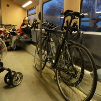
Hackathon will take place in ImpactHub located in the Bratislava centre. Transport options:
List of those who helped to make this event happened.....
If you would like to support and sponsor this event, please get in touch with us.
For further information, recommendations and support, please use this form, or send us an email: